GIS
Maps
The Powell Street neighbourhood or Pauergai was not limited to Powell Street but included the adjacent blocks as well. It was a true community in that people lived and worked there. In the 1930s, there was a Japanese Language school on Alexander Street (it is still there today), a Buddhist church, the park in the centre of the neighbourhood where the Asahi baseball team played, and of course, many shops and services.
The maps below are layered gif images that show colour-coded changes over time. These images were created by the GIS cluster of Landscapes of Injustice.
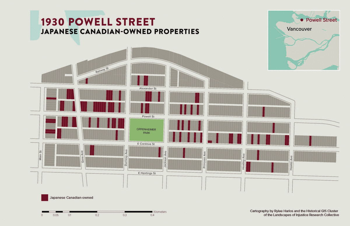
Japanese Canadian-owned properties
This map displays the real estate Japanese Canadians owned in the Powell Street neighbourhood in the 1930s and 1940s. If you watch the changes over time, you will notice how the Japanese Canadian presence in the neighbourhood increases from 1930 and then sharply drops off by 1949. The number of Japanese Canadian residents dropped off in 1942 due to the forced removal. The number of Japanese Canadian owners reduce only, however, when the government forcibly sold their properties.
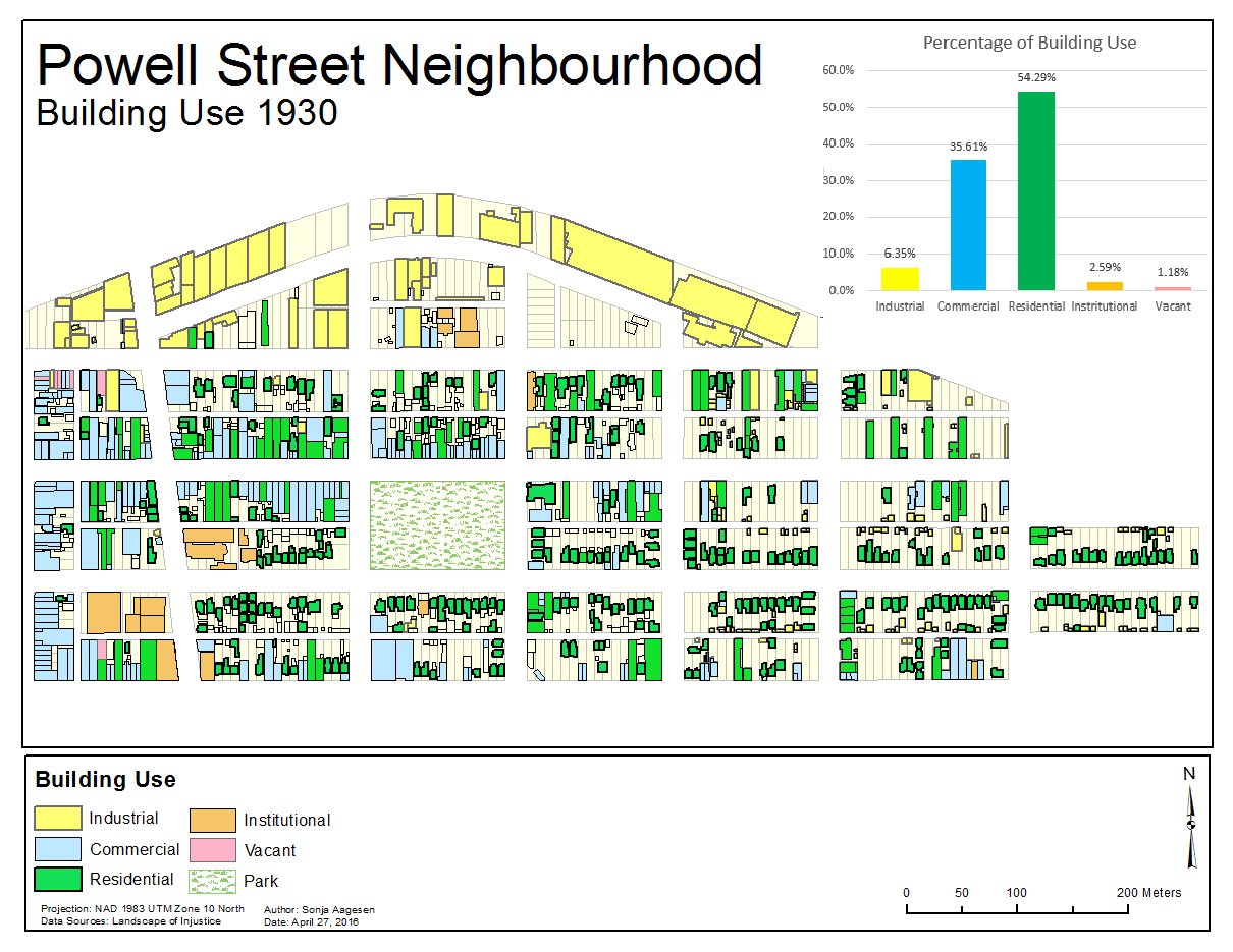
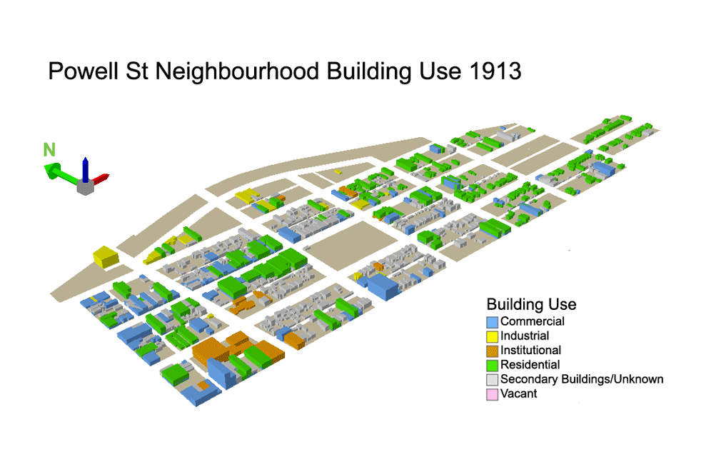
Building Use
Here are two maps that show the changes in building use over
time.
The top one is 2-D and the bottom 3-D.